
Rangpur Division topographic map
Interactive map
Click on the map to display elevation.
About this map
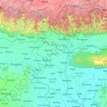
Name: Rangpur Division topographic map, elevation, terrain.
Location: Rangpur Division, Bangladesh (23.23356 86.39400 28.43356 91.59400)
Average elevation: 1,116 m
Minimum elevation: -2 m
Maximum elevation: 8,419 m
Other topographic maps
Click on a map to view its topography, its elevation and its terrain.
Sylhet Division
The region is considered one of the most picturesque and archaeologically rich regions in South Asia. It is home to three national parks; the Lawachara National Park, Khadim Nagar National Park and Satchari National Park, as well as numerous smaller parks and forests such as the Ratargul Swamp Forest,…
Average elevation: 88 m
Pond of Nasu Baklai
Bangladesh > Barishal Division > Borhanuddin Subdistrict > Burhanuddin
Average elevation: 5 m