
Kikyusa topographic map
Interactive map
Click on the map to display elevation.
About this map
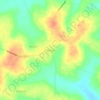
Name: Kikyusa topographic map, elevation, terrain.
Location: Kikyusa, Luweero, Central Region, Uganda (0.81581 32.62402 0.85581 32.66402)
Average elevation: 1,096 m
Minimum elevation: 1,073 m
Maximum elevation: 1,117 m
Other topographic maps
Click on a map to view its topography, its elevation and its terrain.