
Sangju-si topographic map
Interactive map
Click on the map to display elevation.
Sangju-si
All of Sangju lies in the valley of the Nakdong River. Various tributaries flow into the Nakdong in Sangju, including the Yeong (which rises in Mungyeong). The land slopes down from the Sobaek Mountains in the east to the river basin. The highest elevation in Sangju is found at the top of Songnisan, 1,058 m above sea level. Like most of South Korea, the terrain is generally hilly, with only a few flat areas along the rivers. Because of this rugged terrain, 67% of the land in Sangju is classified as "vacant," unused for agricultural or other purposes.
About this map
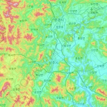
Name: Sangju-si topographic map, elevation, terrain.
Location: Sangju-si, North Gyeongsang, South Korea (36.23742 127.79642 36.65676 128.34117)
Average elevation: 216 m
Minimum elevation: 29 m
Maximum elevation: 943 m
Other topographic maps
Click on a map to view its topography, its elevation and its terrain.