
Kāgbeni topographic map
Interactive map
Click on the map to display elevation.
About this map
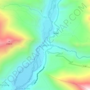
Name: Kāgbeni topographic map, elevation, terrain.
Location: Kāgbeni, Barhagaun Muktikhsetra, मुस्ताङ, Gandaki, Népal (28.81776 83.76431 28.85776 83.80431)
Average elevation: 3,101 m
Minimum elevation: 2,794 m
Maximum elevation: 3,860 m
Other topographic maps
Click on a map to view its topography, its elevation and its terrain.
Barhagaun Muktikhsetra
Barhagaun Muktikhsetra, मुस्ताङ, Gandaki, 33100, Népal
Average elevation: 4,743 m