
Gangneung-si topographic map
Interactive map
Click on the map to display elevation.
About this map
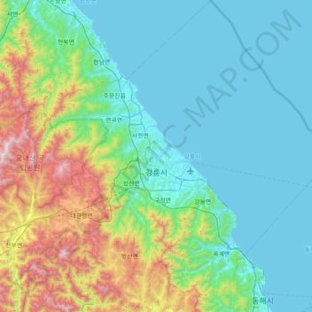
Name: Gangneung-si topographic map, elevation, terrain.
Location: Gangneung-si, Gangwon State, South Korea (37.50330 128.58036 38.05622 129.27575)
Average elevation: 301 m
Minimum elevation: 0 m
Maximum elevation: 1,537 m
Other topographic maps
Click on a map to view its topography, its elevation and its terrain.