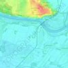
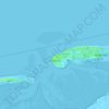
Twixlum topographic map
Click on the map to display elevation.
About this map
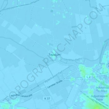
Name: Twixlum topographic map, elevation, terrain.
Location: Twixlum, Lower Saxony, 26723, Germany (53.35081 7.11355 53.39081 7.15355)
Average elevation: -1 m
Minimum elevation: -5 m
Maximum elevation: 7 m
Other topographic maps
Click on a map to view its topography, its elevation and its terrain.



Goslar
Germany > Lower Saxony > Landkreis Goslar
Goslar is situated in the middle of the upper half of Germany, about 40 kilometres (25 miles) south of Brunswick and about 70 km (43 mi) southeast of the state capital, Hanover. The Schalke mountain is the highest elevation within the municipal boundaries at 762 metres (2,500 feet). The lowest point of 175 m…
Average elevation: 312 m
Hanover
Germany > Lower Saxony > Region Hannover
In 1636 George, Duke of Brunswick-Lüneburg, ruler of the Brunswick-Lüneburg principality of Calenberg, moved his residence to Hanover. The Dukes of Brunswick-Lüneburg were elevated by the Holy Roman Emperor to the rank of Prince-Elector in 1692 and this elevation was confirmed by the Imperial Diet in 1708.…
Average elevation: 61 m

Becken
Germany > Lower Saxony > Landkreis Rotenburg (Wümme) > Steddorf > Boitzenbostel
Average elevation: 30 m












Goslar
Germany > Lower Saxony > Landkreis Goslar
Goslar is situated in the middle of the upper half of Germany, about 40 kilometres (25 miles) south of Brunswick and about 70 km (43 mi) southeast of the state capital, Hanover. The Schalke mountain is the highest elevation within the municipal boundaries at 762 metres (2,500 feet). The lowest point of 175 m…
Average elevation: 312 m






Clausthal-Zellerfeld
Germany > Lower Saxony > Landkreis Goslar
Clausthal-Zellerfeld (German pronunciation: [ˈklaʊstaːlˈtsɛlɐfɛlt] ) is a town in Lower Saxony, Germany. It is located in the southwestern part of the Harz mountains. Its population is approximately 15,000. The town hosts the Clausthal University of Technology. The health resort is located in the Upper…
Average elevation: 466 m




Braunlage
Germany > Lower Saxony > Landkreis Goslar
Braunlage is located on the Warme Bode, a headstream of the river Bode, close to the border with Elend in the state of Saxony-Anhalt. The municipal area stretches along the south-eastern rim of the Harz National Park from an elevation of 550 m (1,800 ft) up to 971 m (3,186 ft) at the summit of the Wurmberg.…
Average elevation: 618 m
Sankt Andreasberg
Germany > Lower Saxony > Landkreis Goslar > Braunlage
As a result of their elevation, Sankt Andreasberg (520–720 m) and Sonnenberg (800–850 m) still have fairly guaranteed snow. Sankt Andreasberg is an Alpine Ski Centre of the Harz, with three T-bar lifts on the Sonnenberg as well as two double chair lifts and three T-bars at the Matthias Schmidt Mountain…
Average elevation: 648 m
Bad Essen
Germany > Lower Saxony > Landkreis Osnabrück
The town of Bad Essen is on the North German Plains, because of the transition of the low mountain range to the plains. The Wiehengebirge Range covers approximately the southern third of the town and reaches an elevation of 211m above sea level. The highest point of the Wiehengebirge Range is on the black…
Average elevation: 79 m