
Seogwipo-si topographic map
Interactive map
Click on the map to display elevation.
About this map
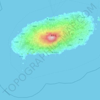
Name: Seogwipo-si topographic map, elevation, terrain.
Location: Seogwipo-si, Jeju, South Korea (33.05587 126.15490 33.48312 127.05885)
Average elevation: 74 m
Minimum elevation: -1 m
Maximum elevation: 1,923 m
Other topographic maps
Click on a map to view its topography, its elevation and its terrain.