
Conway County topographic map
Interactive map
Click on the map to display elevation.
About this map
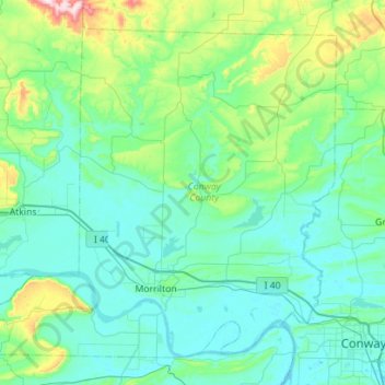
Name: Conway County topographic map, elevation, terrain.
Location: Conway County, Arkansas, United States (35.07143 -93.04082 35.46360 -92.47947)
Average elevation: 155 m
Minimum elevation: 78 m
Maximum elevation: 615 m
Other topographic maps
Click on a map to view its topography, its elevation and its terrain.
Park Addition
United States > Arkansas > Hempstead County > Hope > Park Addition
Average elevation: 102 m
Bella Vista
United States > Arkansas > Benton County > Bella Vista
The city of Bella Vista is located on the Springfield Plateau of the Ozark Mountains. Oak/hickory forests, along with valleys, creeks, and steep rises, characterize the city's topography. Bella Vista is located north of Bentonville and Rogers and is the northernmost Arkansas city in the Standard Metropolitan…
Average elevation: 371 m
North Fordyce
United States > Arkansas > Dallas County > Fordyce > North Fordyce
Average elevation: 79 m