
Lorenzo Geyres topographic map
Interactive map
Click on the map to display elevation.
About this map
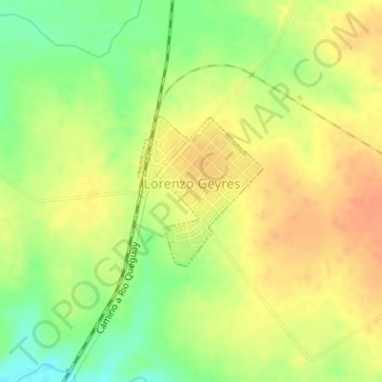
Name: Lorenzo Geyres topographic map, elevation, terrain.
Location: Lorenzo Geyres, Paysandú, 60004, Uruguay (-32.08496 -57.92365 -32.07431 -57.91319)
Average elevation: 37 m
Minimum elevation: 12 m
Maximum elevation: 54 m
Other topographic maps
Click on a map to view its topography, its elevation and its terrain.
Bella Vista
Uruguay > Paysandú > Bella Vista
Bella Vista, Paysandú, 50000, Uruguay
Average elevation: 87 m
Federación
Uruguay > Paysandú > Federación
Federación, Paysandú, 60000, Uruguay
Average elevation: 85 m
Nuevo Paysandú
Uruguay > Paysandú > Nuevo Paysandú
Nuevo Paysandú, Paysandú, 60000, Uruguay
Average elevation: 14 m
Cerro Chato
Uruguay > Paysandú > Cerro Chato
Cerro Chato, Paysandú, 60001, Uruguay
Average elevation: 96 m