Geolocate

Termas del Daymán topographic map

Interactive map

Click on the map to display elevation.

About this map

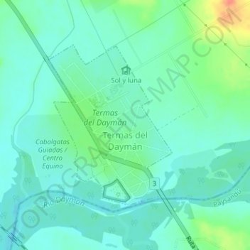
Name: Termas del Daymán topographic map, elevation, terrain.

Location: Termas del Daymán, Salto, 50000, Uruguay (-31.45947 -57.91809 -31.44214 -57.90239)

Average elevation: 21 m

Minimum elevation: 9 m

Maximum elevation: 55 m

Other topographic maps

Click on a map to view its topography, its elevation and its terrain.

Salto

Uruguay > Salto

Salto, Uruguay

Average elevation: 135 m

Constitución

Uruguay > Salto

Constitución, Salto, 50002, Uruguay

Average elevation: 40 m

Salto

Uruguay > Salto

Salto, 50000, Uruguay

Average elevation: 34 m

Toro Negro

Uruguay > Salto

Toro Negro, Salto, Uruguay

Average elevation: 223 m

Las Flores

Uruguay > Salto > Las Flores

Las Flores, Salto, 50000, Uruguay

Average elevation: 105 m