
Constitución topographic map
Interactive map
Click on the map to display elevation.
About this map
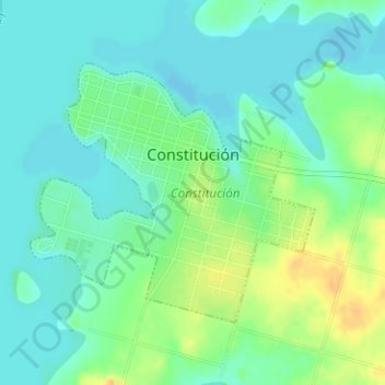
Name: Constitución topographic map, elevation, terrain.
Location: Constitución, Salto, 50002, Uruguay (-31.07901 -57.86271 -31.06083 -57.83939)
Average elevation: 40 m
Minimum elevation: 29 m
Maximum elevation: 59 m
Other topographic maps
Click on a map to view its topography, its elevation and its terrain.