
Shannon Island topographic map
Interactive map
Click on the map to display elevation.
About this map
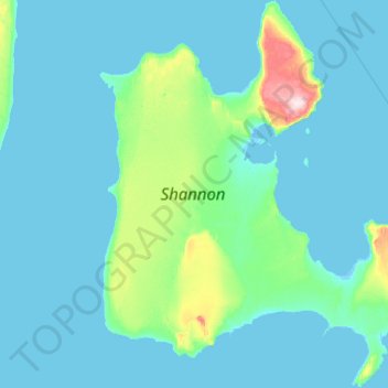
Name: Shannon Island topographic map, elevation, terrain.
Location: Shannon Island, Sermersooq, Greenland (74.92913 -18.92286 75.42671 -17.30225)
Average elevation: 18 m
Minimum elevation: -5 m
Maximum elevation: 300 m
Other topographic maps
Click on a map to view its topography, its elevation and its terrain.
Geographical Society Island
Geographical Society Island, Sermersooq, Greenland
Average elevation: 178 m