White County topographic map
Click on the map to display elevation.
About this map

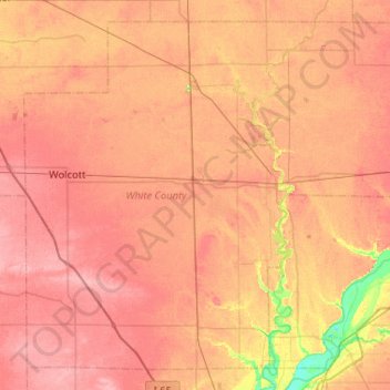
Name: White County topographic map, elevation, terrain.
Location: White County, Indiana, United States (40.56059 -87.09953 40.91250 -86.58017)
Average elevation: 210 m
Minimum elevation: 159 m
Maximum elevation: 236 m
Other topographic maps
Click on a map to view its topography, its elevation and its terrain.

Perth
United States > Indiana > Clay County
Perth, Dick Johnson Township, Clay County, Indiana, 47837, United States
Average elevation: 193 m

Carmel
United States > Indiana > Hamilton County
Carmel, Hamilton County, Indiana, United States
Average elevation: 254 m

Fish Creek
United States > Indiana > LaPorte County > Fish Lake
Fish Creek, Fish Lake, LaPorte County, Indiana, United States
Average elevation: 217 m

Sullivan
United States > Indiana > Sullivan County
Sullivan, Sullivan County, Indiana, 47882, United States
Average elevation: 155 m

Mansfield
United States > Indiana > Parke County
Mansfield, Parke County, Indiana, United States
Average elevation: 196 m

Pleasant
United States > Indiana > Switzerland County
Pleasant, Switzerland County, Indiana, 47224, United States
Average elevation: 282 m

La Porte
United States > Indiana > LaPorte County
La Porte, LaPorte County, Indiana, 46350, United States
Average elevation: 246 m

Santa Claus
United States > Indiana > Spencer County
Santa Claus, Spencer County, Indiana, 47579, United States
Average elevation: 144 m

Columbus
United States > Indiana > Bartholomew County
Columbus, Bartholomew County, Indiana, 47201, United States
Average elevation: 197 m

Lake Station
United States > Indiana > Lake County
Lake Station, Lake County, Indiana, 46405, United States
Average elevation: 189 m

Deer Creek
United States > Indiana > Carroll County > Delphi
Deer Creek, Delphi, Carroll County, Indiana, 46923, United States
Average elevation: 188 m

Chandler
United States > Indiana > Warrick County
Chandler, Warrick County, Indiana, 47610, United States
Average elevation: 129 m

Groomsville
United States > Indiana > Tipton County
Groomsville, Tipton County, Indiana, United States
Average elevation: 275 m

West Lafayette
United States > Indiana > Tippecanoe County
West Lafayette, Tippecanoe County, Indiana, United States
Average elevation: 192 m