
Thasang topographic map
Interactive map
Click on the map to display elevation.
About this map
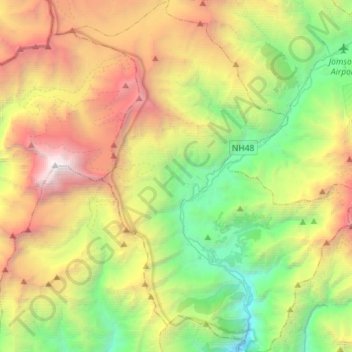
Name: Thasang topographic map, elevation, terrain.
Location: Thasang, मुस्ताङ, Gandaki, Népal (28.56450 83.50279 28.81433 83.73547)
Average elevation: 4,244 m
Minimum elevation: 1,836 m
Maximum elevation: 8,176 m
Other topographic maps
Click on a map to view its topography, its elevation and its terrain.
Lamanthang
Lamanthang, लोमान्थाङ, मुस्ताङ, Gandaki, Népal
Average elevation: 4,899 m
Ekle Bhatti
Népal > मुस्ताङ > Kagbeni > Ekle Bhatti
Ekle Bhatti, Kagbeni, Barhagaun Muktikhsetra, मुस्ताङ, Gandaki Pradesh, Népal
Average elevation: 3,031 m