
Muktinath topographic map
Interactive map
Click on the map to display elevation.
About this map
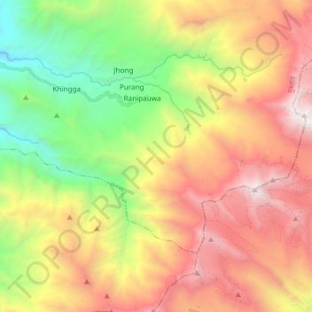
Name: Muktinath topographic map, elevation, terrain.
Location: Muktinath, Barhagaun Muktikhsetra, मुस्ताङ, Gandaki, Népal (28.75121 83.78967 28.83263 83.93883)
Average elevation: 4,668 m
Minimum elevation: 3,001 m
Maximum elevation: 6,475 m
Other topographic maps
Click on a map to view its topography, its elevation and its terrain.
Lamanthang
Lamanthang, लोमान्थाङ, मुस्ताङ, Gandaki, Népal
Average elevation: 4,899 m
Ekle Bhatti
Népal > मुस्ताङ > Kagbeni > Ekle Bhatti
Ekle Bhatti, Kagbeni, Barhagaun Muktikhsetra, मुस्ताङ, Gandaki Pradesh, Népal
Average elevation: 3,031 m