
Wanssum topographic map
Interactive map
Click on the map to display elevation.
About this map
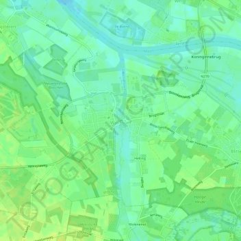
Name: Wanssum topographic map, elevation, terrain.
Location: Wanssum, Venray, Limburg, Nederland (51.52295 6.04735 51.54924 6.10691)
Average elevation: 18 m
Minimum elevation: 10 m
Maximum elevation: 25 m
Wanssum ligt aan de Groote Molenbeek, die hier via de industriehaven uitmondt in de Maas. Het dorp ligt op een hoogte van ongeveer 15 meter. Westelijk van Wanssum bevindt zich het Landgoed Geysteren met het Geysters Ven, in wezen een oude Maasbedding.
Other topographic maps
Click on a map to view its topography, its elevation and its terrain.
Valkenburg
Nederland > Limburg > Valkenburg
Valkenburg, Limburg, Nederland, 6301, Nederland
Average elevation: 121 m
Molsberg
Nederland > Limburg > Simpelveld
Molsberg, Simpelveld, Limburg, Nederland, 6369 GP, Nederland
Average elevation: 172 m
Swartbroek
Swartbroek, Weert, Limburg, Nederland, 6005 PD, Nederland
Average elevation: 31 m
Beertsenhoven
Beertsenhoven, Wijlre, Gulpen-Wittem, Limburg, Nederland, 6321 PR, Nederland
Average elevation: 129 m
Hei
Nederland > Limburg > Kessel-Eik
Hei, Kessel-Eik, Kessel, Peel en Maas, Limburg, Nederland, 5995 SH, Nederland
Average elevation: 27 m
Emmaberg
Nederland > Limburg > Valkenburg
Emmaberg, Valkenburg, Valkenburg aan de Geul, Limburg, Nederland, 6301 RE, Nederland
Average elevation: 116 m
Nijswiller
Nijswiller, Gulpen-Wittem, Limburg, Nederland, 6286 CA, Nederland
Average elevation: 152 m
Dikkenberg
Nederland > Limburg > Wellerlooi
Dikkenberg, Wellerlooi, Bergen, Limburg, Nederland, 5856 CA, Nederland
Average elevation: 21 m
Berg en Terblijt
Nederland > Limburg > Berg en Terblijt
Berg en Terblijt, Limburg, Nederland, 6325, Nederland
Average elevation: 104 m
Mookerheide
Mookerheide, Mook, Mook en Middelaar, Limburg, Nederland
Average elevation: 42 m
Weustenrade
Weustenrade, Klimmen, Voerendaal, Limburg, Nederland, 6343 PX, Nederland
Average elevation: 88 m
Aan de Rijksweg
Aan de Rijksweg, Merum, Herten, Roermond, Limburg, Nederland, 6049 GW, Nederland
Average elevation: 24 m
Oostbroek
Nederland > Limburg > Geulle aan de Maas
Oostbroek, Geulle aan de Maas, Geulle, Meerssen, Limburg, Nederland, 6243 CB, Nederland
Average elevation: 73 m
Altweerterheide
Altweerterheide, Weert, Limburg, Nederland, 6006 TS, Nederland
Average elevation: 34 m
Valkenburg
Valkenburg, Valkenburg aan de Geul, Limburg, Nederland
Average elevation: 123 m
Visserweert
Nederland > Limburg > Roosteren > Visserweert
Visserweert, Roosteren, Echt-Susteren, Limburg, Nederland, 6116 AM, Nederland
Average elevation: 31 m
Bosschenhuizen
Nederland > Limburg > Simpelveld
Bosschenhuizen, Simpelveld, Limburg, Nederland, 6369 BK, Nederland
Average elevation: 171 m