
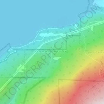
Sturt Creek topographic map
Interactive map
Click on the map to display elevation.
About this map
Name: Sturt Creek topographic map, elevation, terrain.
Average elevation: 606 m
Minimum elevation: 392 m
Maximum elevation: 1,214 m
Other topographic maps
Click on a map to view its topography, its elevation and its terrain.
Watson Bay
Canada > British Columbia > Regional District of Kitimat-Stikine > Area C (Butedale/Kitlope/Kitsumkalum)
Average elevation: 138 m
Cape Palmerston
Canada > British Columbia > Regional District of Mount Waddington > Area B (Quatsino Sound/Cape Scott)
Average elevation: 70 m
Southern Gulf Islands Electoral Area
Canada > British Columbia > Capital Regional District
Average elevation: 35 m
Mount Faulkner
Canada > British Columbia > Cariboo Regional District > Area C (Bowron Lake/Barlow Creek/Barkerville)
Average elevation: 1,721 m
Valemount
Canada > British Columbia > Regional District of Fraser-Fort George
Average elevation: 795 m
Area B (Lazo North)
Canada > British Columbia > Comox Valley Regional District
Average elevation: 11 m
Kitsilano
Canada > British Columbia > Metro Vancouver Regional District > Vancouver
Average elevation: 24 m
Area A (Nass Valley/Bell Irving)
Canada > British Columbia > Regional District of Kitimat-Stikine
Average elevation: 957 m
Mount Mackenzie
Canada > British Columbia > Cariboo Regional District > Area J (West Chilcotin)
Average elevation: 1,861 m
Mount Barrington
Canada > British Columbia > Regional District of Kitimat-Stikine > Area D (Iskut/Big Raven)
Average elevation: 1,437 m
Mount Baldy
Canada > British Columbia > qathet Regional District > Area A (Malaspina/Toba)
Average elevation: 1,246 m
Mount Allen
Canada > British Columbia > Regional District of East Kootenay > Area G (Forster Creek/Mount Assiniboine)
Average elevation: 2,673 m
Miocene
Canada > British Columbia > Cariboo Regional District > Area F (Horsefly/Likely/150 Mile House)
Average elevation: 1,009 m
Kootenay Columbia
Canada > British Columbia > Regional District of Kootenay Boundary > Area B (Lower Columbia/Old Glory)
Average elevation: 1,013 m
Castle Towers
Canada > British Columbia > Squamish-Lillooet Regional District > Area D (Elaho/Garibaldi)
Average elevation: 2,237 m
Mount Shanks
Canada > British Columbia > Regional District of East Kootenay > Area G (Forster Creek/Mount Assiniboine)
Average elevation: 2,274 m
Stoney Creek
Canada > British Columbia > Regional District of Central Kootenay > Area K (The Arrow Lakes)
Average elevation: 1,295 m
Mount Mercer
Canada > British Columbia > Fraser Valley Regional District > Area E (Chilliwack River Valley)
Average elevation: 1,359 m
Mount Crosby
Canada > British Columbia > Peace River Regional District > Area B (Finlay Valley/Beatton Valley)
Average elevation: 2,123 m
Black Bluff
Canada > British Columbia > Regional District of Mount Waddington > Area A (Seymour Inlet/Knight Inlet)
Average elevation: 35 m
Sun Peaks
Canada > British Columbia > Thompson-Nicola Regional District > Sun Peaks Mountain Resort Municipality
Average elevation: 1,490 m
Yoho National Park
Canada > British Columbia > Columbia-Shuswap Regional District
The weather in the park is localized and changeable. Located on the western side of the continental divide, it receives more precipitation than areas east of the divide. Precipitation in the park increases with elevation. In winter, average temperatures are between 5 and −15 °C (41.0 and 5.0 °F) from the…
Average elevation: 1,934 m
Mount Macdonald
Canada > British Columbia > Columbia-Shuswap Regional District > Area A (Kicking Horse/Kinbasket Lake)
Average elevation: 2,019 m
Area F (Kokanee Range)
Canada > British Columbia > Regional District of Central Kootenay
Average elevation: 1,463 m
Buchan Inlet
Canada > British Columbia > North Coast Regional District > Area C (South Skeena)
Average elevation: 39 m
Inskip Point
Canada > British Columbia > North Coast Regional District > Area D (Graham Island)
Average elevation: 14 m
Area B (Cayoosh/Pavilion)
Canada > British Columbia > Squamish-Lillooet Regional District
Average elevation: 1,483 m
Mount Murray
Canada > British Columbia > Columbia-Shuswap Regional District > Area B (Shelter Bay/Mica Creek)
Average elevation: 1,971 m
Bella Bella
Canada > British Columbia > Central Coast Regional District > Area B (Bella Bella)
Average elevation: 48 m
Grant Island
Canada > British Columbia > Regional District of Central Okanagan > Lake Country
Average elevation: 1,101 m
Area D (Oyster Bay/Buttle Lake)
Canada > British Columbia > Strathcona Regional District
Average elevation: 723 m
Blackcomb Glacier Provincial Park
Canada > British Columbia > Squamish-Lillooet Regional District > Whistler Resort Municipality
Average elevation: 2,073 m
Whistler Village
Canada > British Columbia > Squamish-Lillooet Regional District > Whistler Resort Municipality
Average elevation: 775 m
Area A (Kicking Horse/Kinbasket Lake)
Canada > British Columbia > Columbia-Shuswap Regional District
Average elevation: 1,846 m
Whitewater Mountain
Canada > British Columbia > Regional District of Central Kootenay > Area H (The Slocan Valley)
Average elevation: 2,245 m
Razorback
Canada > British Columbia > Alberni-Clayoquot Regional District > Area C (Long Beach)
Average elevation: 946 m
Mission
Canada > British Columbia > Fraser Valley Regional District
The western part of the district, the Stave Valley, is largely rural and forested but its watercourse is home to what was the largest hydroelectric project in British Columbia until the Bridge River Power Project opened in 1961. It was built by the British Columbia Electric Railway (BCER) to provide power to…
Average elevation: 345 m
Tolkien S1
Canada > British Columbia > Squamish-Lillooet Regional District > Area C (Pemberton Valley/Mount Currie/D'Arcy)
Average elevation: 1,954 m
Mount Cooper
Canada > British Columbia > Regional District of Central Kootenay > Area D (Lardeau Valley/Duncan Lake)
Average elevation: 2,480 m
Mount Atkinson
Canada > British Columbia > Regional District of Okanagan-Similkameen > Area E (Naramata/Greyback)
Average elevation: 1,736 m
Surf Islands
Canada > British Columbia > Central Coast Regional District > Area A (Ocean Falls/Outer Coast)
Average elevation: 3 m
Coombs
Canada > British Columbia > Regional District of Nanaimo > Area F (Alberni Highway)
Average elevation: 104 m
Darby Channel
Canada > British Columbia > Central Coast Regional District > Area A (Ocean Falls/Outer Coast)
Average elevation: 113 m
McMurdo
Canada > British Columbia > Columbia-Shuswap Regional District > Area A (Kicking Horse/Kinbasket Lake)
Average elevation: 852 m
40 Mile Flats
Canada > British Columbia > Regional District of Kitimat-Stikine > Area D (Iskut/Big Raven)
Average elevation: 1,105 m
Penticton
Canada > British Columbia > Regional District of Okanagan-Similkameen
Penticton is located at the geographical coordinates of 49°29′28″N 119°35′19″W / 49.49111°N 119.58861°W / 49.49111; -119.58861 (Penticton) and covers an area of 42.10 km2 (16.25 sq mi), with a maximum north–south distance of 7 km (4.3 mi) wide between the Okanagan Lake to the north…
Average elevation: 702 m
Mount Hicks
Canada > British Columbia > Fraser Valley Regional District > Kent
Average elevation: 563 m
Queens Park
Canada > British Columbia > Metro Vancouver Regional District > New Westminster
Average elevation: 57 m
Mount Cairnes
Canada > British Columbia > Columbia-Shuswap Regional District > Area A (Kicking Horse/Kinbasket Lake)
Average elevation: 2,493 m
Gambier Island
Canada > British Columbia > Sunshine Coast Regional District > Area F (West Howe Sound)
Average elevation: 130 m
Rivervale
Canada > British Columbia > Regional District of Kootenay Boundary > Area B (Lower Columbia/Old Glory)
Average elevation: 610 m
Mount Bryan
Canada > British Columbia > Regional District of East Kootenay > Area F (Columbia Lake/Windermere Lake)
Average elevation: 2,060 m
Vancouver Island
Canada > British Columbia > Area D (Oyster Bay/Buttle Lake)
The rain shadow effect of the island's mountains, as well as the mountains of Washington's Olympic Peninsula, creates wide variation in precipitation. The west coast is considerably wetter than the east coast. Average annual precipitation ranges from 6,650 mm (262 in) at Hucuktlis Lake on the west coast…
Average elevation: 411 m
Mount Cole
Canada > British Columbia > Squamish-Lillooet Regional District > Area B (Cayoosh/Pavilion)
Average elevation: 1,480 m
Middle Hill
Canada > British Columbia > North Coast Regional District > Area D (Graham Island)
Average elevation: 248 m
White Rock
Canada > British Columbia > Metro Vancouver Regional District > White Rock > White Rock
Average elevation: 38 m
Juan de Fuca Electoral Area
Canada > British Columbia > Juan de Fuca Electoral Area
Average elevation: 255 m
Arthur Seat
Canada > British Columbia > Thompson-Nicola Regional District > Area I (Blue Sky Country)
Average elevation: 1,327 m
University Endowment Lands
Canada > British Columbia > University Endowment Lands
Average elevation: 33 m