
Ballard County topographic map
Click on the map to display elevation.
About this map
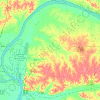
Name: Ballard County topographic map, elevation, terrain.
Location: Ballard County, Kentucky, United States (36.91546 -89.18251 37.23010 -88.81582)
Average elevation: 113 m
Minimum elevation: 87 m
Maximum elevation: 152 m
Other topographic maps
Click on a map to view its topography, its elevation and its terrain.