
Blue Earth County topographic map
Interactive map
Click on the map to display elevation.
About this map
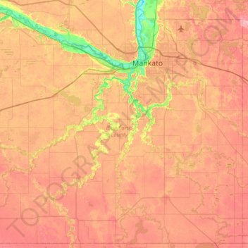
Name: Blue Earth County topographic map, elevation, terrain.
Location: Blue Earth County, Minnesota, United States (43.84787 -94.37106 44.26417 -93.76771)
Average elevation: 305 m
Minimum elevation: 227 m
Maximum elevation: 362 m
Other topographic maps
Click on a map to view its topography, its elevation and its terrain.
Forest Lake
United States > Minnesota > Washington County > Forest Lake > Forest Lake
Average elevation: 277 m
Roseport
United States > Minnesota > Dakota County > Inver Grove Heights > Roseport
Average elevation: 272 m