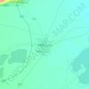
Guizhou topographic map
Click on the map to display elevation.
Guizhou
Guizhou is a mountainous province, with its higher altitudes in the west and centre. It lies at the eastern end of the Yungui Plateau. Demographically, it is one of China's most diverse provinces. Minority groups account for more than 37% of the population, including sizable populations of the Miao, Bouyei, Dong, Tujia and Yi peoples, all of whom speak languages distinct from Chinese. The main language spoken in Guizhou is Southwestern Mandarin, a variety of Mandarin.
About this map

Name: Guizhou topographic map, elevation, terrain.
Location: Guizhou, China (24.62072 103.59999 29.22445 109.59400)
Average elevation: 914 m
Minimum elevation: 68 m
Maximum elevation: 2,813 m
Other topographic maps
Click on a map to view its topography, its elevation and its terrain.
Shanghai
The golden age of Shanghai began with its elevation to municipality on 7 July 1927. This new Chinese municipality covered an area of 494.69 km2 (191.0 sq mi), including the modern-day districts of Baoshan, Yangpu, Zhabei, Nanshi, and Pudong, but excluded the foreign concessions territories. Headed by a Chinese…
Average elevation: 5 m
Chongqing
The central urban area of Chongqing, or Chongqing proper, is a city of unique features. Built on mountains and partially surrounded by the Yangtze and Jialing rivers, it is known as a "mountain city" and a "city on rivers". The night scene of the city is very illuminated, with millions of lights and their…
Average elevation: 318 m
Tai Mo Shan
Tai Mo Shan (大帽山) is the highest peak in Hong Kong, with an elevation of 957 metres (3,140 ft) above the Hong Kong Principal Datum [zh], or around 956 metres (3,136 ft) above mean sea level. It is located at approximately the geographical centre of the New Territories.
Average elevation: 600 m




K2
China > Xinjiang > Cenling County
K2 is nicknamed "The King of Mountains" and "The Mountaineers' Mountain", as well as "The Mountain of Mountains", a phrase popularized by Italian climber Reinhold Messner in his book on K2. Although the summit of Everest is at a higher altitude, K2 is a more difficult and dangerous climb. This is in part due…
Average elevation: 7,482 m




Mount Kailash
China > Xizang > Purang County > Parga town
Mount Kailash (also Kailasa; Kangrinboqê or Gang Rinpoche; Tibetan: གངས་རིན་པོ་ཆེ; simplified Chinese: 冈仁波齐峰; traditional Chinese: 岡仁波齊峰; Sanskrit: कैलास, IAST: Kailāsa), is a mountain in the Ngari Prefecture, Tibet Autonomous Region of China. It has an…
Average elevation: 5,756 m





K2
China > Xinjiang > Taxkorgan Tajik Autonomous County > Dafdar
K2 is nicknamed "The King of Mountains" and "The Mountaineers' Mountain", as well as "The Mountain of Mountains", a phrase popularised by Italian climber Reinhold Messner in his book on K2. Although the summit of Everest is at a higher altitude, K2 is a more difficult and dangerous climb. This is in part due…
Average elevation: 7,482 m



Xi'an
China > Shaanxi > Weiyang District > Xi'an
Xi'an lies on the Guanzhong Plain in the south-central part of Shaanxi province, on a flood plain created by the eight surrounding rivers and streams. The city has an average elevation of 400 metres (1,312 ft) above sea level and an annual precipitation of 553 mm (21.8 in). The urban area of Xi'an is located…
Average elevation: 412 m




K2
China > Xinjiang > Taxkorgan Tajik Autonomous County > Dafdar
K2 is nicknamed "The King of Mountains" and "The Mountaineers' Mountain", as well as "The Mountain of Mountains", a phrase popularised by Italian climber Reinhold Messner in his book on K2. Although the summit of Everest is at a higher altitude, K2 is a more difficult and dangerous climb. This is in part due…
Average elevation: 7,482 m




Changji
China > Xinjiang > Changji City > Changji/Sanji
Surface water includes glaciers, snowmelt, rivers, springs, lakes, reservoirs, and irrigation channels. Glaciers and perennial snow cover mirror altitudes above 3,800 m—present in all counties except Mulei, serving as “natural reservoirs” for runoff. The basin's rivers are short and reliant on mountain…
Average elevation: 1,309 m




Himalayas
The Himalayas, or Himalaya (/ˌhɪməˈleɪ.ə, hɪˈmɑːləjə/ HIM-ə-LAY-ə, hih-MAH-lə-yə), is a mountain range in Asia, separating the plains of the Indian subcontinent from the Tibetan Plateau. The range has some of the Earth's highest peaks, including the highest, Mount Everest. More than 100 peaks…
Average elevation: 2,385 m