
Manawatāwhi / Three Kings Island topographic map
Interactive map
Click on the map to display elevation.
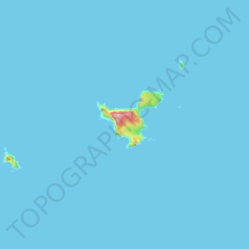
Manawatāwhi / Three Kings Island
With an area of 4.04 square kilometres (1.56 sq mi), Manawatāwhi / Great Island is by far the largest island of the group. A northeastern peninsula, with an area of about 1 km2, is almost cut off by a 200 m wide but more than 80 m high isthmus formed by North West Bay and South East Bay. The island reaches an elevation of 295 m in the western part, while the peninsula is up to 184 m high near its western cliffs. The southern portion consists of the Tasman Valley, a series of rolling hills that draining into the Tasman Stream. Most of the Māori archaeological features on the islands are found in this area.
About this map
Name: Manawatāwhi / Three Kings Island topographic map, elevation, terrain.
Location: Manawatāwhi / Three Kings Island, New Zealand (-34.18994 172.02977 -34.12957 172.16851)
Average elevation: 3 m
Minimum elevation: 0 m
Maximum elevation: 287 m
Other topographic maps
Click on a map to view its topography, its elevation and its terrain.
Mount Tūtoko
New Zealand > Southland > Southland District > Fiordland Community
Average elevation: 1,892 m
Kawarau Gorge
New Zealand > Otago > Central Otago District > Cromwell Community
Average elevation: 339 m
Ohai
New Zealand > Southland > Southland District > Wallace Takitimu Community
Average elevation: 188 m
Māhoenui
New Zealand > Waikato > Waitomo District
Māhoenui is located in the King Country approx 50 kilometres (31 mi) inland from the west coast of the North Island, the topography is hilly to mountainous, with small alluvial areas near the streams and river.
Average elevation: 113 m
Te Haumi
New Zealand > Northland > Far North District > Bay of Islands-Whangaroa Community > Paihia
Average elevation: 34 m
Tōtara North
New Zealand > Northland > Far North District > Bay of Islands-Whangaroa Community
Average elevation: 67 m
Waiouru
New Zealand > Manawatu-Whanganui > Ruapehu District
Because of its high altitude and close proximity to Mt Ruapehu, Waiouru's climate is cold throughout the year, unlike other North Island centres, and particularly cold when the wind blows from the mountain. The Desert Road is regularly closed in winter owing to heavy snowfalls. Waiouru's climate can be…
Average elevation: 817 m
Methven
New Zealand > Canterbury > Ashburton District
Methven (Māori: Piwakawaka) is a small town in the Canterbury region of the South Island of New Zealand. It is located near the western edge of the Canterbury Plains, 35 km (22 mi) north of Ashburton and 95 km (59 mi) west of Christchurch, and at an elevation of 320 m (1,050 ft). The town is a service centre…
Average elevation: 322 m
Forest Range
New Zealand > Southland > Southland District > Waihopai Toetoe Community
Average elevation: 373 m
Pearce
New Zealand > Canterbury > Christchurch City > Banks Peninsula Community
Average elevation: 485 m