
Vestre Slidre topographic map
Interactive map
Click on the map to display elevation.
About this map
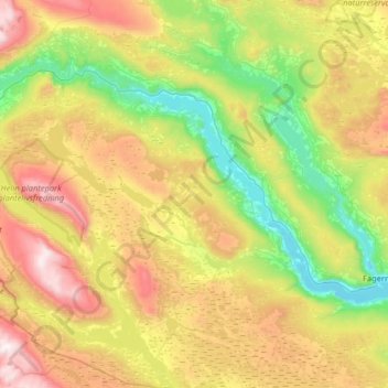
Name: Vestre Slidre topographic map, elevation, terrain.
Location: Vestre Slidre, Innlandet, Norway (60.89663 8.65405 61.20964 9.17874)
Average elevation: 878 m
Minimum elevation: 352 m
Maximum elevation: 1,768 m
Other topographic maps
Click on a map to view its topography, its elevation and its terrain.