
Tundra topographic map
Click on the map to display elevation.
About this map
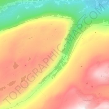
Name: Tundra topographic map, elevation, terrain.
Location: Tundra, Skjåk, Innlandet, Norway (61.79157 7.83017 61.91252 8.04782)
Average elevation: 1,279 m
Minimum elevation: 446 m
Maximum elevation: 2,093 m
Other topographic maps
Click on a map to view its topography, its elevation and its terrain.