Geolocate

Ringebu topographic map

Interactive map

Click on the map to display elevation.

About this map

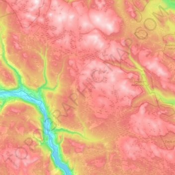
Name: Ringebu topographic map, elevation, terrain.

Location: Ringebu, Innlandet, Norway (61.36245 9.93865 61.75177 10.70504)

Average elevation: 911 m

Minimum elevation: 177 m

Maximum elevation: 1,456 m

Other topographic maps

Click on a map to view its topography, its elevation and its terrain.

Rena

Norway > Innlandet

Average elevation: 281 m

Fall

Norway > Innlandet

Average elevation: 259 m

Brigaden

Norway > Innlandet

Average elevation: 474 m

To

Norway > Innlandet > Otta

Average elevation: 583 m

Lillehammer

Norway > Innlandet

Average elevation: 360 m

Tynset

Norway > Innlandet

Average elevation: 596 m

Otta

Norway > Innlandet

Average elevation: 719 m

Lom

Norway > Innlandet

Average elevation: 600 m

Beitostølen

Norway > Innlandet

Average elevation: 914 m

Flisa

Norway > Innlandet

Average elevation: 195 m

Alstad

Norway > Innlandet > Lena

Average elevation: 262 m

Ottestad

Norway > Innlandet > Ottestad

Average elevation: 192 m

Tundra

Norway > Innlandet

Average elevation: 1,279 m

Bjorli

Norway > Innlandet

Average elevation: 686 m