
Rabbit Island topographic map
Interactive map
Click on the map to display elevation.
About this map
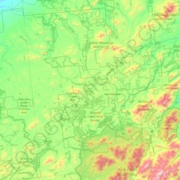
Name: Rabbit Island topographic map, elevation, terrain.
Average elevation: 549 m
Minimum elevation: 178 m
Maximum elevation: 1,607 m
Other topographic maps
Click on a map to view its topography, its elevation and its terrain.
Saratoga County
Saratoga County is situated in the eastern portion of New York State, north of the state capital city of Albany, northwest of Troy, and east of Utica. According to the U.S. Census Bureau, the county has a total area of 844 square miles (2,190 km2), of which 810 square miles (2,100 km2) are land and 34 square…
Average elevation: 218 m
Wyandanch
United States > New York > Suffolk County > Town of Babylon
The community was formerly known as Half Way Hollow Hills, West Deer Park (beginning in 1875), and Wyandance (in 1888). Topographically, Wyandanch's nutrient-poor loam and sandy soils are part of the outwash plain which was formed as the last glacier melted about 10,000 BCE. The outwash plain slopes gently…
Average elevation: 21 m
Village of Potsdam
United States > New York > Saint Lawrence County > Town of Potsdam
Average elevation: 133 m
North Patchogue
United States > New York > Suffolk County > Town of Brookhaven
Average elevation: 15 m
South Huntington
United States > New York > Suffolk County > Town of Huntington
Average elevation: 60 m
Village of Lake Placid
United States > New York > Essex County
Lake Placid is well known among winter-sports enthusiasts for its skiing, both Alpine and Nordic. Whiteface Mountain (4,867 ft or 1,483 m), in nearby Wilmington about 13 miles (21 km) from Lake Placid, offers skiing, hiking, gondola rides, and mountain biking, and is the only one of the High Peaks that can be…
Average elevation: 558 m
Village of Walden
United States > New York > Orange County
The Wallkill passes through a small gorge between the two dams and loses approximately 60 feet (18 m) of elevation in the process. The surrounding topography in the village is, correspondingly, gentle rolling hills of this section of the Great Appalachian Valley between the higher rises of the Shawangunk…
Average elevation: 114 m
Village of Clinton
United States > New York > Oneida County > Town of Kirkland
Average elevation: 191 m
The Bronx
United States > New York > New York
The Bronx's highest elevation at 280 feet (85 m) is in the northwest corner, west of Van Cortlandt Park and in the Chapel Farm area near the Riverdale Country School. The opposite (southeastern) side of the Bronx has four large low peninsulas or "necks" of low-lying land that jut into the waters of the East…
Average elevation: 23 m
Village of Buchanan
United States > New York > Westchester County > Town of Cortlandt
Average elevation: 28 m
Village of Orchard Park
United States > New York > Erie County > Town of Orchard Park
Average elevation: 262 m
Village of Red Creek
United States > New York > Wayne County > Town of Wolcott
Average elevation: 107 m
Village of Tuxedo Park
United States > New York > Orange County > Town of Tuxedo
Average elevation: 230 m
Saint John's Park
United States > New York > New York
It took over 20 years for all the lots to be sold and developed, partly because of the swampy topography, but also because the church was only offering 99-year leases, not outright ownership of the lots, with covenants which limited the heights of residences and the materials they were built with. During this…
Average elevation: 11 m
Chautauqua County
The county is generally composed of rolling hills and valleys, with elevations ranging anywhere between 1100 and 2100 feet, although the land within a few miles of Lake Erie is generally flat and at an elevation of 1000 feet or lower. The lowest point in the county is Lake Erie, at 571 feet (174 meters), and…
Average elevation: 328 m