
Sør-Rokta topographic map
Interactive map
Click on the map to display elevation.
About this map
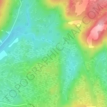
Name: Sør-Rokta topographic map, elevation, terrain.
Location: Sør-Rokta, Steinkjer, Trøndelag, Norway (63.98094 11.95954 63.99119 12.00190)
Average elevation: 214 m
Minimum elevation: 165 m
Maximum elevation: 315 m
Other topographic maps
Click on a map to view its topography, its elevation and its terrain.
Norway
Norway's topography is defined by its rugged and varied terrain, shaped by ancient geological processes and glacial activity. Dominating the landscape are the Scandinavian Mountains, which run through the country and include peaks like Galdhøpiggen, the highest in Northern Europe at 2,469 meters (8,100 feet).…
Average elevation: 143 m
Stavanger
The municipality of Stavanger is located in a coastal landscape, bordering the sea to the west and Boknafjorden in the northeast. The Byfjorden and Gandsfjorden run along the east side of the city. It is part of the Low-Jæren, a flat area of land consisting mostly of marsh, sand, and stone aur, that ranges…
Average elevation: 42 m
Reine
Allers, the largest weekly magazine in Norway, selected Reine as the most beautiful village in Norway in the late 1970s. A photograph over Reine from the mountain Reinebringen (altitude 448 metres (1,470 ft)) has been used for the front page of several tourist brochures and books. In 1999 the painter Ingo…
Average elevation: 58 m
Nordland
In the geological past, a collision with Greenland pushed long slices of the seabed on top of the existing bedrock, today forming the bedrock from Dovrefjell and Trollheimen south of Trondheim stretching north in Trøndelag and through Nordland to justh north of Tromsø. This Cambrian—Silurian bedrock, much…
Average elevation: 259 m
Jan Mayen
Jan Mayen consists of two geographically distinct parts. Nord-Jan has a round shape and is dominated by the 2,277 m (7,470 ft) high Beerenberg volcano with its large ice cap (114.2 km2 or 44 sq mi), which can be divided into twenty individual outlet glaciers. The largest of those is Sørbreen, with an area of…
Average elevation: 23 m