
Orchon topographic map
Interactive map
Click on the map to display elevation.
About this map
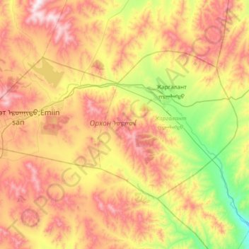
Name: Orchon topographic map, elevation, terrain.
Location: Orchon, Mongolei (48.89917 103.97378 49.13159 104.57044)
Average elevation: 1,290 m
Minimum elevation: 836 m
Maximum elevation: 1,853 m
Other topographic maps
Click on a map to view its topography, its elevation and its terrain.
Charchorin
Mongolei > Öwörchangai > Charchorin
Charchorin, Öwörchangai, Mongolei
Average elevation: 1,592 m
Цэнгэл ᠴᠡᠩᠭᠡᠯ
Mongolei > Bajan-Ölgii > Tsengel
Цэнгэл ᠴᠡᠩᠭᠡᠯ, Tsengel, Bajan-Ölgii, Mongolei
Average elevation: 1,955 m
Arwaicheer
Mongolei > Öwörchangai > Arvaikheer
Arwaicheer, Arvaikheer, Öwörchangai, Mongolei
Average elevation: 1,820 m
Tschoibalsan
Tschoibalsan, Kherlen, Dornod, Mongolei
Average elevation: 764 m
Чулуут ᠴᠢᠯᠠᠭᠤᠲᠤ
Mongolei > Archangai > Chuluut
Чулуут ᠴᠢᠯᠠᠭᠤᠲᠤ, Chuluut, Archangai, Mongolei
Average elevation: 2,096 m
Tsetserleg
Mongolei > Archangai > Erdenebulgan > Tsetserleg
Tsetserleg, Erdenebulgan, Archangai, -0976, Mongolei
Average elevation: 1,813 m
Erdenet
Mongolei > Orchon > Bayan-Öndör
Erdenet, Bayan-Öndör, Orchon, Mongolei
Average elevation: 1,381 m
Хутаг-Өндөр
Mongolei > Bulgan > Хутаг-Өндөр
Хутаг-Өндөр, Khutag-Öndör, Bulgan, Mongolei
Average elevation: 1,024 m